Krakatoa – the day the world exploded
By Pam Hamer
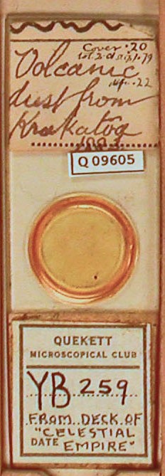
One of the slides recorded during the cataloguing of the Club’s slide collection was particularly interesting. Having just purchased Simon Winchester’s recent book The Day the World Exploded – Krakatoa, I was intrigued to see one slide with a label ‘Volcano dust from Krakatoa 1883’.

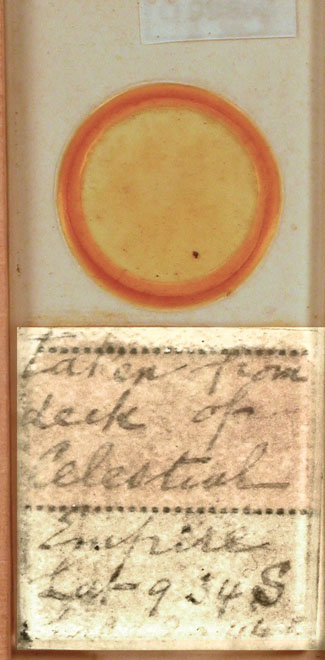
A Quekett label had been attached to the lower part of the slide with the legend ‘From deck of Celestial Empire’, but viewed from the underside it was apparent that this covered another label. Tony Dutton took a digital image of the reverse of the slide, increased the contrast and reversed the image, and this revealed the inscription on this label. On this was written ‘Taken from deck of Celestial Empire’ but it also included ‘Lat 9.34S’.

Krakatoa was at 6°06′ S, 105°25′ E. It therefore appears the Celestial Empire was 3° away from the eruption. Winchester (on page 285) says that “Dust of all grades and composition was thrown into the air by the eruption. Much of it, too heavy to be kept on high for long, fell as drifting veils of grey, and was widely reported as having done so. Ships at sea experienced dust falls for a fortnight after the eruption; the Brani and British Empire came under a slow rain of white ash that one master said ‘looked like Portland cement’ when they were sailing in the Indian Ocean within a 200 mile range of the volcano; the Scotia experienced falling dust until 8 September, when she was off the Horn of Africa, 3700 miles away.”
Note by Tony Jarratt
I was intrigued by this piece, and thought it worthwhile to do a little research on the Internet, which resulted in the following information:
At around this period, there were two ships sailing under the name of “Celestial Empire”, the first being an American-registered vessel, but this was lost at sea in 1878, so can be discounted.
The second was built in 1877 and was still afloat in 1911, when she was apparently broken up.
The details in Lloyd’s Register of Shipping are:
Celestial Empire – Iron ship (Sailing vessel)
Built August 1877 by Osbourne, Graham & Co, Sunderland
1832 GRT [Assume this to be Gross Registered Tonnage]
267.2ft long, 40.1ft broad, 23.9ft deep
Two decks, one bulkhead
Owners: G Duncan & Co, 2 East India Avenue, London
Port of registration: London
Master: J Duncan. (Captain Duncan was her Master from her launch until 1907, when Captain G. Rochester was appointed.)
Still owned by Duncan’s in 1911
Although it can’t be proved at this point, this is most likely the ship noted on the slide.

